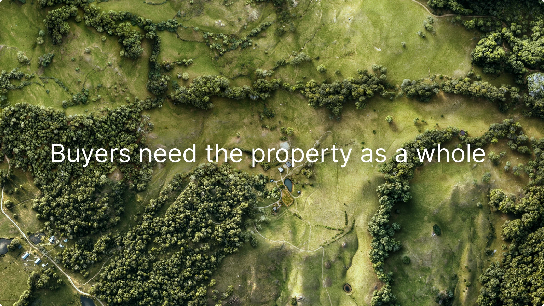
Large land listings are usually presented through fragments: photos, maps, descriptions, satellite views, parcel references, and technical layers. Each fragment can be useful. None of them, by itself, gives the buyer a controlled visual model of the property as a whole.
This matters at the first decision point: when the buyer decides whether the land is worth deeper attention.
For houses, the listing format is built around recognizable signals: exterior photo, rooms, square footage, interiors, floor plans, and lifestyle images. For land, the primary asset is different. Value is shaped by terrain, vegetation, open areas, water, access, structures, privacy, surrounding context, and the relationship between all of these elements.
When those relationships are not visible early, the property is not fully present in the listing.
The problem
Standard listing media splits the land across separate sources.
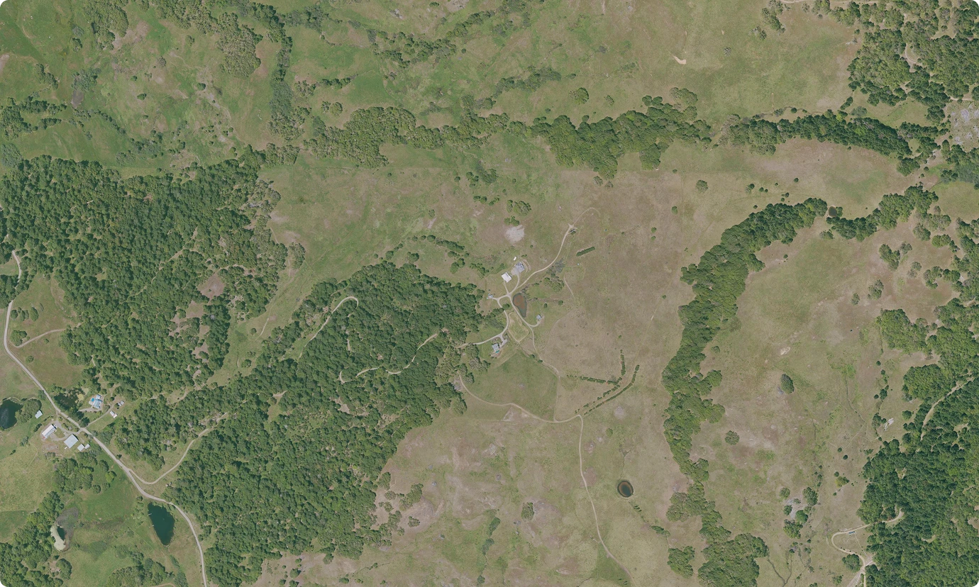
Standard listing media splits the land across separate sources.
The buyer sees ground photos, drone views, map screenshots, satellite imagery, parcel references, descriptions, and sometimes technical material. The information exists, but it is not organized into one buyer-readable representation of the property.
A satellite view can show coverage, but it remains flat, generic, and difficult to interpret. Terrain data can reveal slope, drainage, ridges, and landform, but that layer is usually absent from the listing experience. Descriptions can name features, but they cannot make the buyer see how those features fit together.
The result is fragmentation.
The listing shows parts of the land before the buyer understands the land itself.
For a large property, this is not a cosmetic issue. A buyer should not have to reconstruct the value of the land by moving between photo galleries, map panels, satellite layers, parcel outlines, and long text descriptions. By the time that work is required, part of the audience has already moved on.
The first screen matters. The first visual read matters. The first clear sense of the property matters.
If the land is the main asset, the listing needs a visual layer that shows the land as the main asset.
What gets lost
Large land is not understood only by acreage.
Acreage is a number. The property is a spatial experience.
Buyers need to understand the relationship between open land and forest, high ground and low ground, structures and access, water and terrain, usable areas and surrounding context.
This relationship is what turns land from an abstract parcel into a specific place.
Photos show moments. Maps show location. Satellite views show coverage. Topo and terrain data show structure. Descriptions name features.
But the buyer still has to assemble the property mentally.
That mental assembly creates friction, delay, and uncertainty exactly where the listing should create recognition.
The visual study
Terraxis approaches the property as a visual study.
The work begins with multiple layers of information: aerial imagery, terrain structure, visible land features, vegetation, open areas, roads, water, structures, and surrounding context. These sources are not presented as separate technical layers. They are interpreted and composed into a single buyer-facing visual reference.
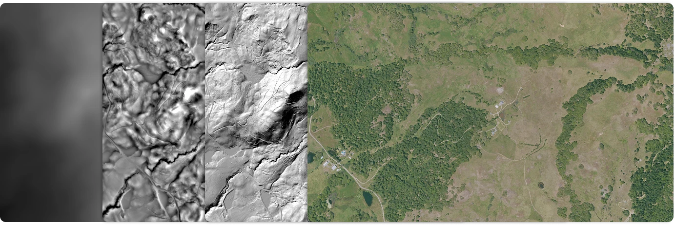
The output is a property-specific visual study, packaged as a presentation-ready land overview for the listing or a private buyer presentation.
It is not a satellite screenshot. It is not a decorative illustration. It is not a survey or legal boundary map.
The goal is to show the property closer to how it is understood as a place: terrain, access, vegetation, water, structures, open areas, and context working together.
This gives the listing a visual layer that standard media does not provide.
Why this matters inside the listing
A listing is not only a storage place for property information. It is a sequence of decisions.
It shapes the first buyer decision: keep going or move on.
A buyer sees a preview. They decide whether to open the listing. They scan the first media. They decide whether the property deserves deeper attention. They compare it with other properties. They discuss it with partners, family, investors, or advisors. They decide whether it is worth a visit.
A property-specific land overview affects this sequence because it gives the buyer a usable visual model early.
It can work as:
The practical shift
Without a whole-property visual layer, the buyer often evaluates land through abstract filters: price, acreage, distance, bedroom count, rough location, and a few attractive photos.
That is not enough for complex land.
A large ranch, acreage estate, remote retreat, timber property, or development site has value in the way its parts relate. The buyer needs to see why this land is different before they are asked to invest time in deeper research or a site visit.
A Terraxis visual study creates that first framework.
It helps the listing move from scattered information to a controlled visual understanding of the property.
It helps buyers see why the land is worth a closer look.
It is a buyer-facing visual orientation layer.
Its purpose is to help the property be understood before the buyer moves into deeper verification, technical review, or in-person evaluation.
Built for complex land listings
This format is most relevant when the land itself carries the value of the listing:
A specialized Terraxis format
Property-specific visual studies by Terraxis.
Geospatial visualization for high-value land.
For presentation-use limits and source context, see legal and data source notes.